| FAA Identifier: |
S30 |
| Lat/Long: |
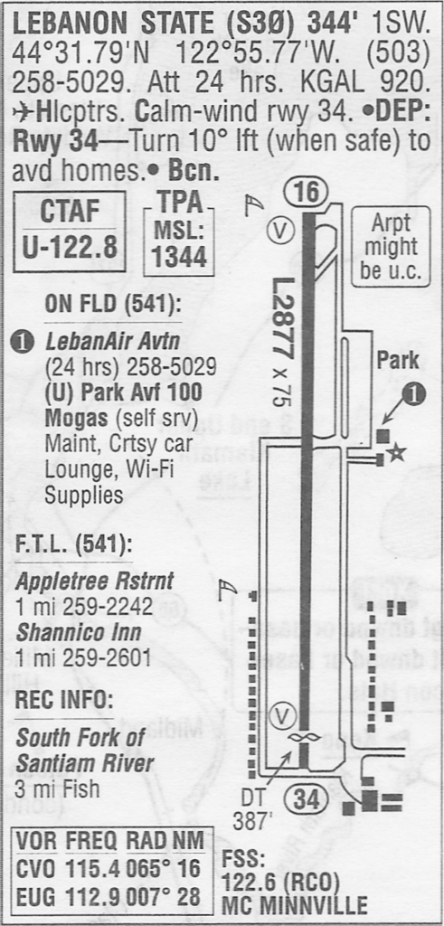
44-31-47.4420N / 122-55-46.3210W
44-31.790700N / 122-55.772017W
44.5298450 / -122.9295336
(estimated) |
| Elevation: |
344 ft. / 105 m (estimated) |
| Variation: |
19E (1985) |
| From city: |
1 mile SW of LEBANON, OR |
| Time zone: |
UTC -7 (UTC -8 during Standard Time) |
| Friendly factor: |
11 |
Runway / Taxiway
| Airport use: |
Open to the public |
| Activation date: |
08/1942 |
| Sectional chart: |
KLAMATH FALLS |
| Control tower: |
are you kidding? |
| ARTCC: |
SEATTLE CENTER |
| FSS: |
MC MINNVILLE FLIGHT SERVICE STATION |
| NOTAMs facility: |
MMV (NOTAM-D service available) |
| Attendance: |
CONTINUOUS |
| Pattern altitude: |
1344 ft. MSL |
| Wind indicator: |
lighted |
| Segmented circle: |
no |
| Lights: |
DUSK-DAWN |
| Beacon: |
white-green (lighted land airport) |
Airport Communications
| CTAF/UNICOM: |
122.8 |
| WX AWOS-3 at CVO (16 nm W): |
135.775 (541-754-0081) |
Nearby radio navigation aids
| VOR radial/distance |
|
VOR name |
|
Freq |
|
Var |
| CVOr065/15.7 |
|
CORVALLIS VOR/DME |
|
115.40 |
|
18E |
| EUGr007/27.6 |
|
EUGENE VORTAC |
|
112.90 |
|
20E |
| NDB name |
|
Hdg/Dist |
|
Freq |
|
Var |
|
ID |
| LEWISBURG |
|
091/15.4 |
|
225 |
|
18E |
|
LWG |
.-.. .– –. |
Airport Services
| Fuel available: |
100LL & Unleaded MOGAS (non-ethanol) |
| Parking: |
tiedowns |
| Airframe service: |
MAJOR |
| Powerplant service: |
MAJOR |
| Bottled oxygen: |
NONE |
| Bulk oxygen: |
NONE |
Runway Information
Runway 16/34
| Dimensions: |
2877 x 60 ft. / 877 x 18 m |
| Surface: |
asphalt, in excellent condition |
| Runway edge lights: |
medium intensity |
|
RUNWAY 16 |
|
RUNWAY 34 |
| Traffic pattern: |
left |
|
left |
| Displaced threshold: |
no |
|
387 ft. |
| Markings: |
basic, in good condition |
|
basic, in good condition |
| Visual slope indicator: |
2-light PAPI on left(3.00 degrees glide path) |
|
2-light PAPI on left (3.50 degrees glide path) |
| Obstructions: |
35 ft. tree, 785 ft. from runway, 16:1 slope to clear |
|
56 ft. brush, 693 ft. from runway,150 ft. left of centerline, 8:1 slope to clear
+15 FT ROAD AT 130 FT. |
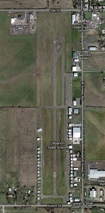
at Lebanon State Airport (S30)


